In the context of the AGROMET project, we need CORINE land cover data and digital terrain model to improve models.
I refer you to my other posts about CORINE land cover (CLC) :
How to get CLC data from Wallonia
Solve a problem in computing the area of each polygon inside a buffer
This post deals with the methodology which was applied to prepare data before using them in our models.
CLC
First, I was focused on CORINE land cover data. My work has two parts :
A part about physical stations, i.e. stations from PAMESEB network where data are available
Another part on the grid of Wallonia with virtual stations (one for each km²)
Virtual stations
Different methods were used to observe CORINE land cover near to each virtual station.
First, a grid of Wallonia with cells of 1km² has been created. It is a simple feature sf.
Using centroid of each cell and creating a buffer around
I refer you to the bottom of this page where I have already explained the method.
The limit of this method is that we have a loss of information between every virtual station with gap in the map. That is an important problem for the future predictions.
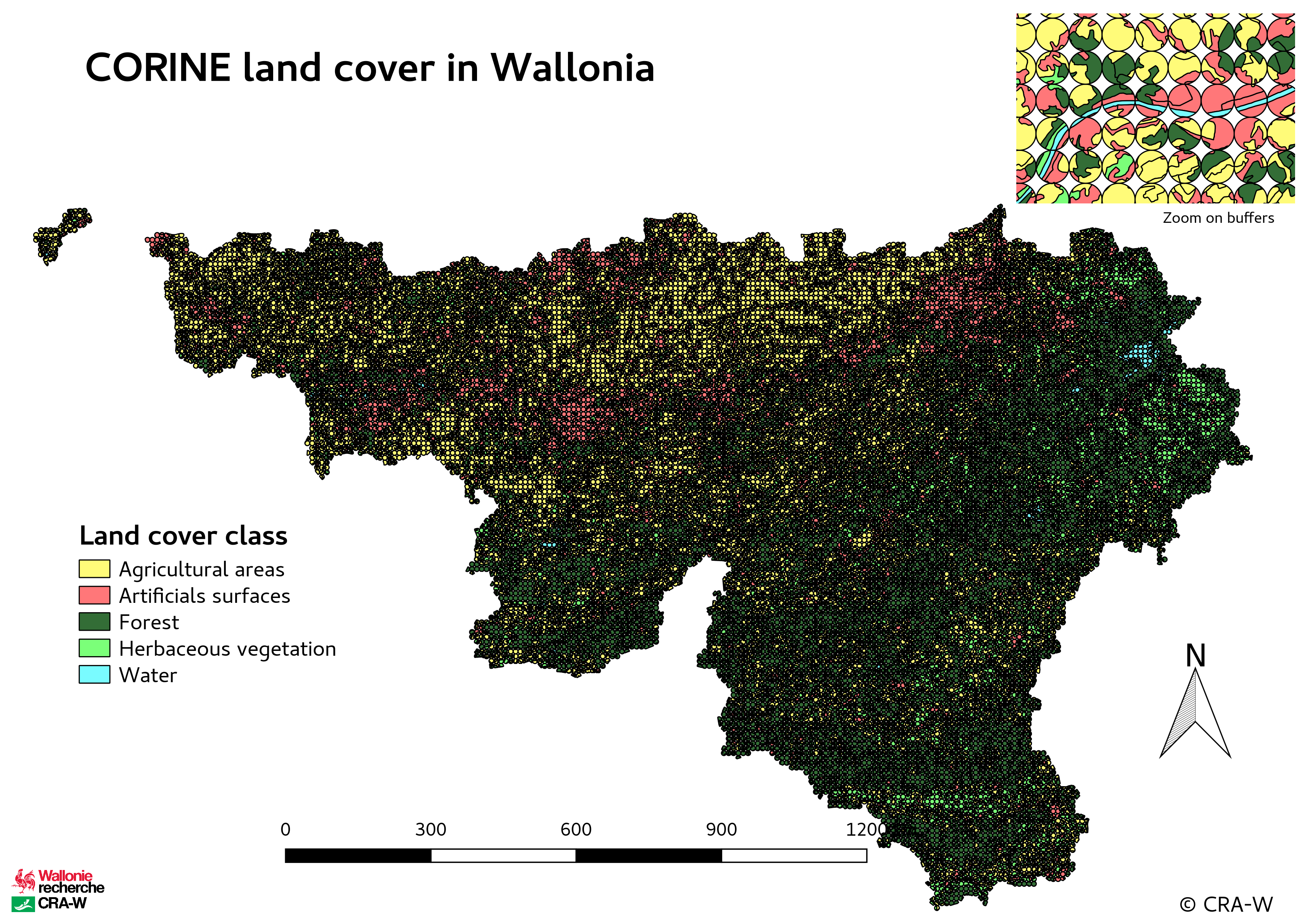
Buffers
##        sid Agricultural areas Herbaceous vegetation    Forest
## 1     vs_1          53.715238             44.050842  0.000000
## 2    vs_10           9.880474             55.039849 33.858245
## 3   vs_100          74.292621             23.349854  1.167155
## 4  vs_1000           0.000000              0.000000 99.995888
## 5 vs_10000          15.540447              3.680151  0.000000
## 6 vs_10001           9.923178             48.652962  5.173979
##   Artificials surfaces Water
## 1             0.000000     0
## 2             1.217319     0
## 3             1.186258     0
## 4             0.000000     0
## 5            80.775290     0
## 6            36.245769     0
Using entire cell
This time, I will use all the cell and not only its centroid.
The method was close to the precedent one with buffers but I will have no gap in my map.
I used simple features sf for computations but I had a problem with the function st_intersection(). Indeed, an error appeared :
Error in CPL_geos_op2(op, st_geometry(x), st_geometry(y)) : TopologyException: Input geom 1 is invalid: Ring Self-intersection at or near point [coordinates of the point].
After a long investigation, the solution we found was to install a new package : lwgeom to use a function which works with st_intersection(). Then, the issue was solved.
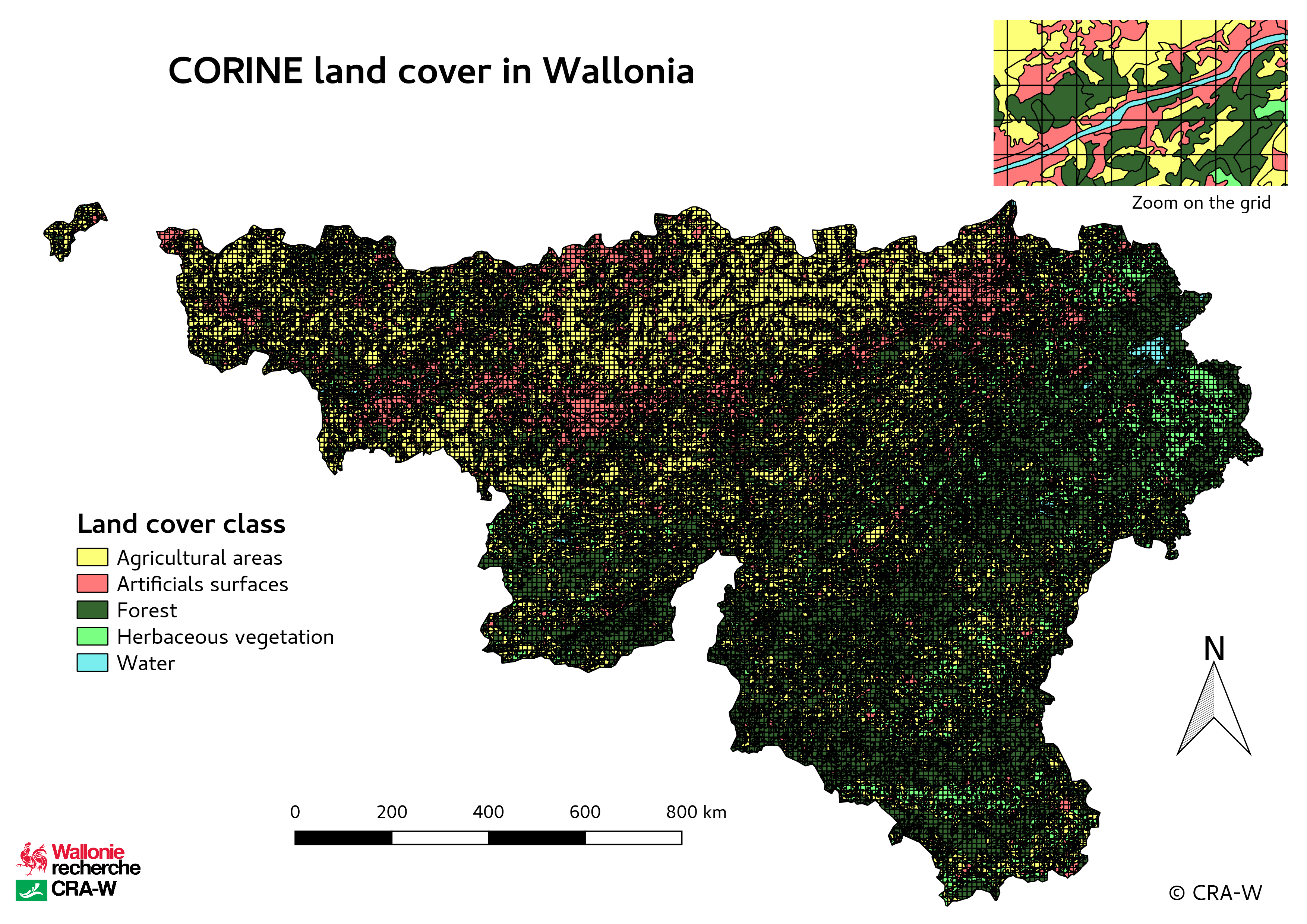
Grid
##        sid Agricultural areas Artificials surfaces    Forest
## 1     vs_1           2.884731            0.0000000   0.00000
## 2    vs_10          40.573362            0.0000000  59.42664
## 3   vs_100           0.000000            0.2237628  99.73470
## 4  vs_1000           0.000000            0.0000000 100.00000
## 5 vs_10000           0.000000            0.0000000 100.00000
## 6 vs_10001           0.000000            0.0000000  81.60053
##   Herbaceous vegetation Water
## 1           97.11526925     0
## 2            0.00000000     0
## 3            0.04153773     0
## 4            0.00000000     0
## 5            0.00000000     0
## 6           18.39947191     0